
 |
 |
 |
 |
 |
 |
 |
 |
 |
 |
Landscape
Geology | Leeds and Liverpool Canal | Mining | Trees
The underlying solid geology of the area consists of Upper Carboniferous Silesian Limestones. Newburgh lies on the edge of the Lower Wesphalian, mainly productive, coal measures. These are generally well covered by thick glacial and post-glacial deposits, primarily comprised of thick tills (stiff clay) but with extensive Shirdley Hill sand deposits and coarse textured, fluvio-glacial deposits overlying the till. North of Newburgh, there is riverine alluvium along the valley of the River Douglas.
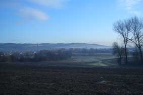
The village is on the eastern edge of the West Lancashire plain, and the landscape is very gently rolling. Newburgh is situated on slightly elevated ground at a height of 25-30m above sea level, sloping gently down to the River Douglas to the east and north and very gradually to a small tributary of the River Douglas, to the south-east.
Landscape towards Parbold Hill
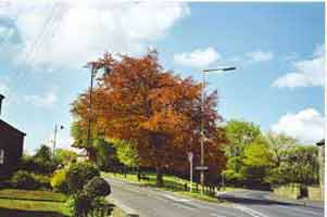
The countryside rises sharply to the east, beyond Parbold village to Parbold Hill at around 130m above sea level. Newburgh is surrounded by Green Belt and lies within a lowland area of mixed arable and pasture farming, comprising mainly improved pasture with arable fields. The field pattern is large-scale, with loss of hedgerow and hedgerow trees. Woodland is sparse outside the historic parks such as Lathom.
Source: Newburgh Conservation Area Appraisal, Egerton Lea Consultancy for West Lancashire District Council May 2004
A stretch of the canal – the longest in Britain – passes along the northern edge of Newburgh. The canal was originally proposed in Yorkshire as a means of transporting limestone for land improvement and for use as a building material. The export of textiles was also a motive. Sponsors in Liverpool, on the other hand, wanted a canal to transport coal from Wigan for manufacturing and shipping. Both needs were eventually served, with coal being the main cargo.
Also skirting Newburgh is the River Douglas which itself had been made navigable from Wigan to the River Ribble and the sea before the construction of the Leeds and Liverpool canal. The Douglas Navigation, with transport of coal a prime motive, was completed in 1742.
In 1771 the Leeds and Liverpool company acquired the Douglas Navigation, providing an essential supply of water to the canal and, by 1774, making the canal navigable from Liverpool to Wigan by linking to a section of the Douglas. The Douglas was made redundant a few years later when a new canal section was built alongside it.
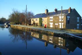
Leeds and Liverpool Canal at Spencer's Bridge
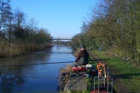
Fishing on the canal
The opening of the Douglas Navigation and of the Leeds and Liverpool Canal both stimulated small-scale coal mining at Newburgh. By 1845 a number of operating and former coal shafts were dotted around the village. The centre of mining was at Newburgh Colliery, situated behind the Red Lion Hotel.
Today little evidence of the industry remains. The wharves by the canal have disappeared as has the road to the canal from the centre of the village. A large depression marks the site of the colliery.
To the south side of Christ Church is an area now known as The Dell. It was formerly a sand quarry.
The Dell
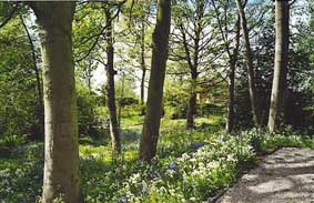
While not a heavily wooded area, the village nonetheless has more than 500 large trees – mostly ash, oak, beech and sycamore, although there are many other species too. Most trees are growing at the side of the road, with a few in private gardens. However, there is a splendid copse of beech trees on the village green, and many ash and sycamore in Christ Church churchyard.
Trees on the Green
Few of the trees in Newburgh are more than 100 years old, many having been planted in the last 40 years with new housing development. There is, however, a group of very old apple trees in ground adjacent to the school.
Tree Warden: For advice on village trees and bushes in public spaces please contact Sandy Beswick Tel 01257 462314
For further information on the Leeds and Liverpool Canal:
- Clarke, Mike The Leeds and Liverpool Canal – A History and Guide. Carnegie Publishing 1994
- www.llcs.org.uk
- www.waterscape.com/canals-and-rivers/leeds-and-liverpool-canal